Off the beaten track, East to Northwest. Climb mountains, cut through deep valleys and cruise along fjords to the architectural gem of Ålesund surrounded by the ocean.
Following this route gives you a rich experience of some spectacular parts of Norway. To avoid the worst traffic, parts of the route is on gravel, in scenic and quiet surroundings. The trip should be quite easy for an experienced cyclist, with only one really steep but short part on the way. Once by the fjords there are also a couple of ferries to get you across the water, while you get time to really take in the vistas.

This route is best for gravel bike (or similar) in the summer or early autumn. It brings you east to west mostly on quiet roads or through nature, with some exceptions, where you’ll share the road with more traffic. The nature along the route changes from cultivated valleys to alpine mountains and exceptional views to glaciers, powerful waterfalls and deep fjords. You’ll also get to small villages and see beautiful traditional farms along the road. The journey ends in the architectural gem of Ålesund, rising from the Atlantic Ocean with its turrets and towers.
The route is easy accessible by train, starting at the railway station in Otta. From Ålesund you can continue cycling on the Eurovelo 1 along the Atlantic Coast, or there is a bus back to the railway line in Åndalsnes, You can also jump on a plane or boat to other destinations. Ålesund is served daily by international flights to Amsterdam, and weekly to Alicante, Copenhagen, Gdansk and London. (2025).
As this cycling route is parallell to popular roads and tourist destinations throughout the summer, you should find all kinds of accommodation along the way, from camping sites to pensions and hotels. There are places to fill up or stay the night all along the route, like in Vågå, Lom, Hjelle and Hellesylt.
The route described here is divided into three legs with a total of 325 kilometres and with more than 3000 meters of climbing. Some parts of the route is on a main road, which can be busy especially in summer, with buses, campers and trucks. Mornings are usually less busy when it comes to traffic. Much of the route is on quiet backroads or on tracks without any cars around. Be prepared by bringing lights for some tunnels and for the climb to Flofjellet where you’ll have to push your bike the steepest part. But it is rewarded when you get up and can continue through the mountains only surrounded by grassing cows and waterfalls. There will also be a couple of ferries along the route, both on the last leg described here.
First leg – Otta to Pollfoss (103 km)
Ottadalen – The Otta Valley, is one of the driest areas in Norway. This has kept farmhouses and churches standing for centuries, which is easy to notice as you follow the Otta river. One of the first places to consider making a stop is the cycling shop at Lalm – JT Sykkel. It’s basically not a place where you would expect to find an expert mechanic selling the best of bicycles, but he is here for you. Not far after Lalm the route takes you up Sjårdalen, a well manicured landscape of neat houses and farming.
Våga is the next little village on the route. It is known for how they keep a strict policy to keep the vernacular building style of log houses and dark colours. Add to this local cafes selling the typical sour cream porridge – rømmegrøt. It’s perfect for worn out cyclists, and really necessary to continue on the next part with gravel roads going up and down.

This next part along Vågåvatnet takes you to Lom, also called Fossbergom. The name meaning “waterfall rocks”. This is a meeting point by the waterfall where two important roads between east and west meets. Here is also a stave church, one of the oldest in Norway, dating back to 1170. Lom has everything you need to fill up before you continue, and one of the reasons many travelers stop here, is the renown Bakeriet i Lom (The Bakery in Lom), selling thousands of high quality bread buns and sweet pastries every day.
The last part of the first leg continues west into Skjåk. This is in the middle of the Norwegian mainland, as dry as Sahara, and about as high as you can grow anything in Norway. In this area they have specialized in barley, used for porridge, or popular among cyclists to pick up from the dairy shelves in the supermarkets, byggrynslunsj (barley lunch) with blueberry or raspberry jam – all in one package with a spoon included.
Second leg – Polfoss to Hellesylt (108 km)
This part takes you across the mountain range that divides east and west in Norway. The first part is on the main road, but you can avoid much of the traffic by setting off early. The climb is long but not very steep.
At Grotli, just by a hotel on the right side, turn left for Gamle Strynefjellsveg. Now you’re on the old road, with less traffic, avoiding the long tunnels. This paved road takes you through a mountain landscape and westward until you’re on the edge where the road drops down in an endless number of serpentines. Here you’ll get a great view, into the lush west coast valley, and with the edge of the glaciers hanging in the mountains around. On the way down the the old and the new road comes together again, and you’ll be in the main traffic again for some kilometres.

Hjelle is a recommended stop down in the valley. This is a quiet little settlement by the water, with an old hotel and some cabins around. They even have a café (Gamlebutikken på Hjelle) by the hotel, situated on the old quay, where they among other things also serve English afternoon tea, with sandwiches and scones. Recommended for hungry cyclists.
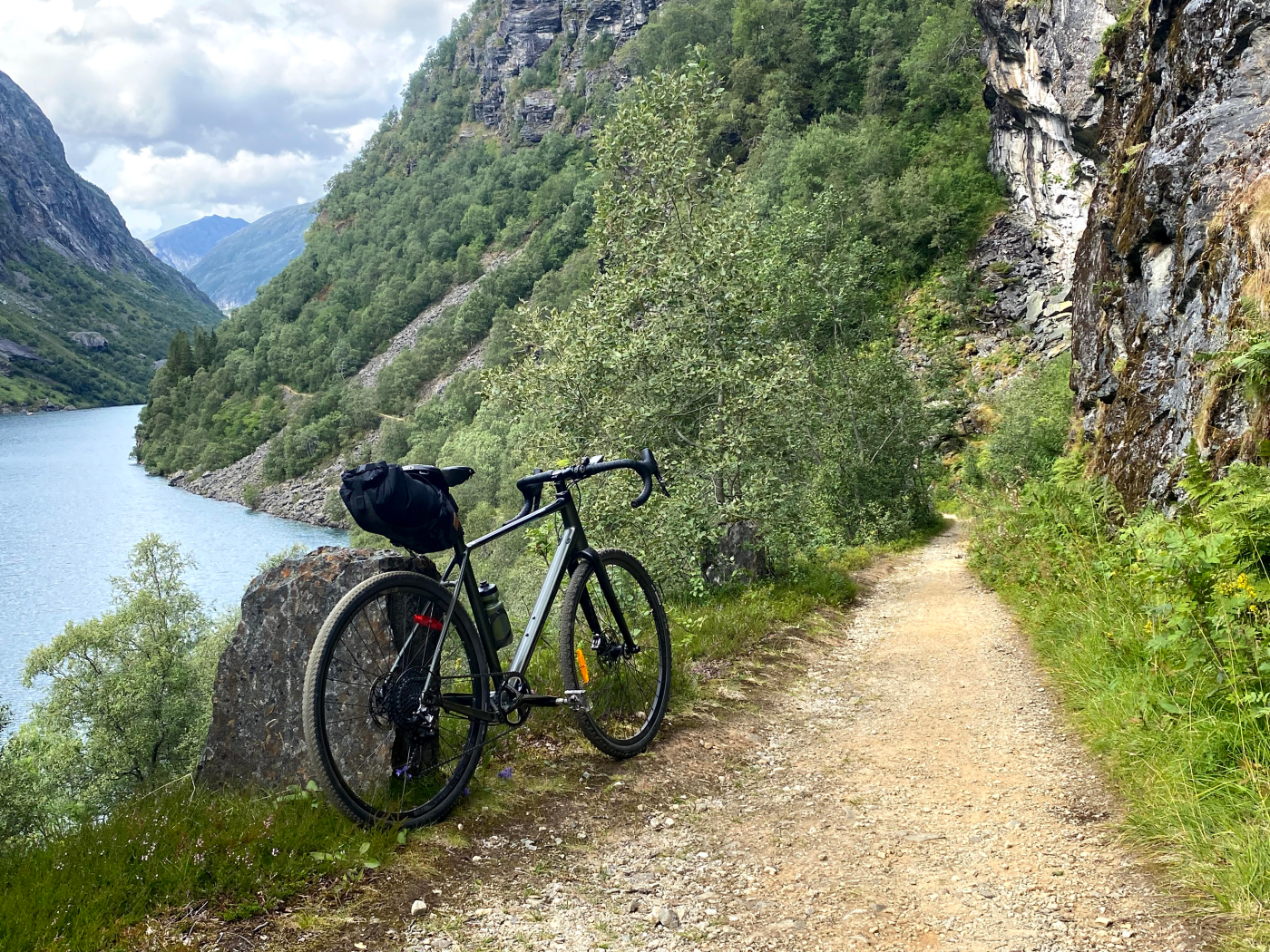
After a stop at Hjelle, continue around Strynsvatnet (The Stryn Lake), and you’ll find an old road on the outside of the tunnels on the way to Flo. Here you will not only get a perfect view back to the mountains and the glaciers, but you will find yourself on one of the most beautiful parts of the route. This is a car-free part, with the old tunnels carved through the mountain, magnificent vistas at every turn and lush green canopies hanging over the road. The beauty comes with a price though, with a danger for avalanches og rockslides. Take especially care in wet periods or in spring when rocks are moved by melting snow and water much higher up. Dry summer days are usually quite safe.

From the little settlement Flo, you’ll start on the part called “Flofjellsvegen” (The Flo Mountain Road) and you’ll meet the steepest part of the road, and many finds it most safe to push the bicycle up this bit. This also gives you the opportunity to turn your head sometimes to enjoy the views back til the lake and into the Jostedalsbreen glacier in the mountains on the opposite side. This is the largest glacier in the Norwegian mainland. As you get up another world opens up. Now you’re in a valley with grassing cattle and no cars around. You´ll pass a little water on the west side, then a summer farm and some cabins, before the track follows the next water on the east side. The quality of the track is quite good considering that it is constructed in a slope made up of rocks that has fallen down the mountainside.
The last part of this leg of the route is a joy. After Flofjellsvegen the road takes you through three steps with interlinked valleys, with farms around, waterfalls and gorges close by. It is like riding in a fantasy-landscape, expecting dragons and elfs. At Hellesylt sea level is reached and at the end of this leg. Here is a choice of camping sites, hotels and even a youth hostel. It can be crowded during the summer season, as this is part of a massive tourist route with av ferry between Hellesylt and Geiranger.
Third leg – Hellesylt to Ålesund (114 km)
At Hellesylt you can swim in salt water of the ocean, and there is actually a rare historical bathing house on a pier on a beach to the west of the village. Try it if you can. The village of Hellesylt is seated just beneath a powerful waterfall, and it is also the place to take the ferry on the Geirangerfjord – a tourist destination since the 1850s. Now it is part of a UNESCO World Heritage Landscape. Before starting off the ride, why not get yourself av coffee at Hellesylt Boutique & Bar, in one of the charming old houses in the village?

The first climb out of Hellesylt is steep, but not very long. Now the route follows the main road to the southwest for almost five kilometres, before you can leave this road to follow the signs towards Ørsta and Øye. Now you are about to enter the alpine mountains of Sunnmøre – Sunnmørsalpane. This first part of the last leg is a 30 km ride through Norangsdalen and along Norangsfjorden. Keep your camera ready, as this is a breathtaking stretch which you will want to record in one way or another.
When you reach the fjord again you’re at the little settlement of Øye, just beneath one of the most popular peaks to climb in Norway – Slogen. It is not for bringing your bike up though, but hiking boots will be OK. At Øye you’ll also find The Union Hotel, a well kept jewel of a historical building extended recently in its original Scandinavian National Romantic Style. It has been the base for the earliest British mountain expeditions to Norway during the 19th century, and visited by a range of celebrities ranging from writers to royalties during the years. Now it’s your turn, if it’s within your budget. Another alternative for filling up is at Urke, just 6 km further on the road along the fjord.
Urke has a camping site, and a little grocery shop. This is lively little place during summer, especially in July, with hikers preparing for climbing into the mountains, and with a little port for the cabin cruisers and sailboats, mostly escaping Ålesund to find more stable summer weather in the fjords. And now it´s your turn to get aboard.
After Urke awaits Leknes where there is a ferry crossing of 13 minutes. Prepare yourself by checking the timetable at frammr.no or entur.no. This ferry takes you to Sæbø, and it is free. Here it is also possible to do a shortcut. The continuing route described here takes you around the mountains on the other side and to the next ferry close to Ålesund. But at Leknes you can also just criss cross the Hjørundfjord to Lille Standal, and get almost to the same place without the big round. This ferry route doesn’t leave that often, so check the timetable. It might even be just as easy to continue around the mountains on the other side of Hjørundfjord.

The part of the Route from Sæbø to Festøy is between the two ferries, and it takes you through some of the most majestic mountain areas in Norway. Even though the mountains around you rise to almost 1500 meters the highest part of the route is less than 400 meters above sea level. This part of the route is just to be enjoyed as it brings you along green pastries, between old farms and on quiet roads, around the mountains and back to Hjørundfjord again. Follow the fjord north, and be prepared with lights on your bike when passing through some short tunnels. At Festøy there is another ferry which will bring you to Solavågen for the last part of the route, entering Ålesund. Mind that there is also another ferry from Festøy to Hundeidvik, so get on the right boat – to Solavågen.
When cycling from Solavågen to Ålesund you are back in the city, with traffic around and houses everywhere. The route takes you around the basin of Borgundfjorden which Ålesund is basically built around. The city centre is found where the route ends close to the sea, in the port of Ålesund.
The historical part of Ålesund is reckoned to be among the most beautiful among Norwegian cities, with its Art Nouveau architecture as the result of a disastrous fire in which burnt down the whole city in a stormy night the 23rd of January 1904. Just three years later much of it was rebuilt, but now the houses were built in brick stones instead of wood, which was the most common way to build in Norway. The architecture is influenced by international trends at the turn of the century, but it was also the result of a growing consciousness about what could be a Norwegian style. Norway was still in a union with Sweden, after another longer union with Denmark, and was just about to find back to its own roots. This took shape also in the buildings in Ålesund, with some adapting the houses to the climate by simplifying the facades, using Norwegian stone for roofing and even on the walls. Others found inspiration in Norse mythology, adding dragons and ornaments inspired by carvings in wood on stave churches and viking ships. Towers and turrets were also used everywhere, with medieval castles as their motif. All this makes Ålesund special in an international setting, with one of the most dense collections of Art Nouveau houses in a city. Add to this the natural setting, with sea all around, always changing views as you move around, and the possibility to see it all from above from the mountain Aksla. You can get there from climbing the 424 steps from the city centre, or just cycle around.

View first leg from Otta to Polfoss here: https://ridewithgps.com/routes/51179691
View second leg from Polfoss to Hellesylt here: https://ridewithgps.com/routes/51179721
View third leg from Hellesylt to Ålesund here: https://ridewithgps.com/routes/51179704

Leave a comment